
Cartografía planetaria
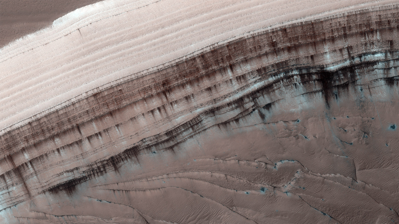
Nuestro grupo tiene larga experiencia en la utilización de técnicas de teledetección y espectroscopía para mapear y analizar superficies planetarias, con énfasis en la criosfera antártica y otros planetas potencialmente habitables.
PROYECTOS desde 2021

PALANTARICE
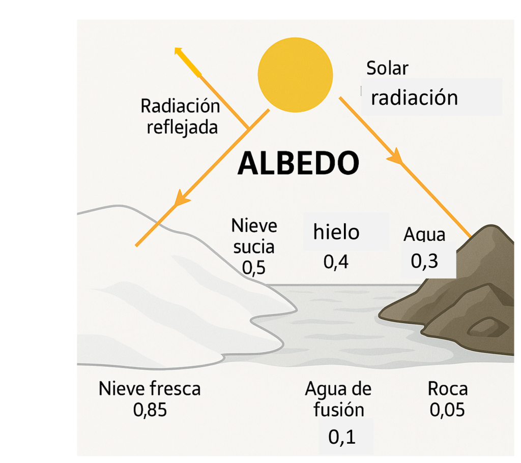
Project coordinated by Susana del Carmen Fernández and Javier F Calleja, aimed at characterizing, quantifying, and transferring to satellite images (MODIS, Sentinel, etc.) all the glacier surface variables that affect the snow and ice albedo in Antarctica, in order to analyze their spatio-temporal evolution at different scales.
SO1: To carry out the geomorphological characterization of the surface roughness of the ice cap at different metric scales (small features, crevasses, sastrugi and megadunes) and to analyze the relation of roughness with the local meteorological conditions, the relief and the optical properties of snow and ice.
SO2: To study the nature and origin of snow impurities and their influence on the albedo
SO3: To calculate the time components of albedo time series (short-, mid- and long term components) and the percentage of different cover types over an ice cap.
SO4: To estimate the thickness of the snow layer affecting the albedo.
SO5: To build spectroscopic libraries (VIS-NIR; Raman) of ice and snow types via in-situ spectroscopic characterisation.
SO6:To model with geostatic and machine learning techniques the relations between the albedo, the meteorology, roughness, impurities and the local relief to extend the results to the Hurd Peninsula and extensive areas of Western Antarctic Ice Sheet (WAIS)
SO7: Designed a the portable albedometer to patent. Applicability of spectral libraries in Planetary Exploration and Astrobiology
PALBANTAR
Project coordinated by Susana del Carmen Fernández and Javier F Calleja
O1: Study Albedo Variations in Antarctica: Characterize the spatial and temporal variations of albedo in Antarctic glaciers, focusing on continuous and twilight illumination conditions.
O2: Develop Predictive Albedo Models: Create models that integrate satellite data, ground-based measurements, and atmospheric factors to enhance understanding of radiative processes in the cryosphere.
O3: Evaluate the Impact of Atmospheric Factors and Contaminants: Analyze the influence of water vapor and impurities, such as black carbon and microbial communities, on the reflectivity of ice and snow.
Specific Objectives:
SO1: Characterize Albedo Under Different Lighting Conditions
SO2: Obtain spatially distributed surface water vapour mapping in the Hurd Peninsula and Deception Island.
SO3: Evaluate the Impact of Water Vapor on Albedo.
SO4:Conduct Sampling Campaigns for Impurities.
SO5: Investigate the Role of Impurities in Albedo Reduction.
SO6: Integrate Satellite and Ground-Based Observations.
SO7: Expand the Use of Antarctica-Specific Algorithms
SO8: Develop a Predictive Model for Daily Integral Albedo
SO9:Outreach

LUNATIKA
Project LUNÁTIKA: Educational Innovation through Lunar Photography
The University of Oviedo is launching Project LUNÁTIKA, an educational innovation initiative that combines astronomy, geosciences, mathematics, and geospatial technologies with an interdisciplinary and cross-level approach.
Coordinated by Professor Susana Fernández Menéndez and Enrrique Díez Alonso, this project integrates content from Calculus, Geomorphology, Geomatics, and Geographic Information Systems (GIS), and is aimed at students from various undergraduate and master’s programs. Its goal is to promote active learning and collaboration across different educational levels.
The project also involves other faculty members and researchers, such as Professor of External Geodynamics Montserrat Jiménez Sánchez and Dr. Raquel Perdiguer López. Professionals from the private sector have also joined the initiative, including engineer Juan Menéndez Blanco (TWave) and astrophysicists Lucía González Cuesta and Xuan González Fernández, both from the company Allende Stars.
Otros Proyectos del Grupo
1.- CTM2017-84441-R. Interacción termomecánica glaciar-océano: estimación de las pérdidas de masa glaciar por ablación frontal y su fraccionamiento en descarga de icebergs y fusión submarina. Convocatoria: Resolución de la Agencia Estatal de Investigación de 08/06/2017. 01/01/2018 al 31/12/2021.
2.- CTM2014-52021-R. Caracterización y evolución de la cubierta nival y su efecto en el régimen térmico del permafrost y la capa activa en las islas Livingston y Decepción (Antártida). Ministerio de Economía y Competitividad (Proyectos de I+D+I, del Programa Estatal de Investigación, Desarrollo e Innovación Orientada a los Retos de la Sociedad. Convocatoria 2014). 1/1/ 2015 – 31/12/2018.
3.- CTM2008-03677-E, Propiedades del regolito en la cuenca de limnopolar (peninsula de byers, antártica) como base de un futuro monitoreo de procesos periglaciares. REGLIMNOPOLAR. Funded by: MICIT. Type of call: National. Pariticipating organizations: Universidad de Oviedo. Duration: from: 01/10/2009 to: 31/12/2010
